IUCN/SSC Otter Specialist Group Bulletin

|
©IUCN/SCC Otter Specialist Group Volume 28 Issue 2 Pages 62 - 118 (October 2011) Citation: Urban, P., Balázs, C., Lantos, I., Gáspár, S., Joó, M., and Harmos, K. (2011). Eurasian Otter (Lutra lutra) in the Central Part of the Slovak-Hungarian Border Area. IUCN Otter Spec. Group Bull. 28 (2): 99 - 112 Eurasian Otter (Lutra lutra) in the Central Part of the Slovak-Hungarian Border Area Peter Urban1, Csaba Balázs2, István Lantos3, Sebastián Gáspár4, Miklós Joó3 and Krisztián Harmos3
1Department of Biology and Ecology, Faculty of Natural Sciences, Matthias Belius University, Tajovského 40, 974 01 Banská Bystrica, Slovakia. e-mail: Peter.Urban@umb.sk; urbanlutra@gmail.com |
 |
| Received 26th October 2011, accepted 27th November 2011 |
| Abstract: The mapping of the Eurasian otter (Lutra lutra) distribution in the central part of the Slovak-Hungarian border was undertaken in winter 2010/2011 by searching for signs of presence of the otter. Authors checked 351 chosen survey sites (50-m transects, 242 points in Hungary and 109 in Slovakia). At every site, all signs of otter presence were surveyed. Preferably, survey sites were located under bridges (299). Sites were considered as either “positive” or “negative”. In total, 155 sites (44.1%, 105 in Hungary and 50 in Slovakia) were positive and 196 (55.8%, 137 in Hungary and 59 in Slovakia) were negative. Otters deposited spraints usually on specific substrate, mostly on blocks (201; 27.3%), concrete (189, 25.7%), and stone concrete (125, 17.0%). Altogether, 185 (61.9%) bridges and culverts were passable and 114 (38.1%) were not passable for the otters during mapping. The otters were regularly observed in optimal habitats (e.g. Ipeľ and Zagyva rivers and its larger tributaries) but also in suboptimal and marginal habitats such as regulated and narrow brooks and channels. The otter population in the central part of the Slovak-Hungarian border area was considered stable and otters occurred throughout this area. |
| Keywords: Lutra lutra, mapping, distribution, spraints, bridges, habitats, southern Slovakia, northern Hungary |
| Française | Español |
INTRODUCTION
The Eurasian otter (Lutra lutra) is a semiaquatic, territorial carnivore living in a large variety of aquatic habitats (Conroy and Chanin, 2002) and represents a flagship species for undisturbed rivers as well as for wetland recovery (Kruuk, 2006). The species has been protected in Slovakia since 1949 (Urban et al., 2011) and in Hungary since 1974, and this became strictly enforced from 1978 onwards (Kemenes, 1991). In the latest Red List of mammals of Slovakia, the otter is listed as “Vulnerable” (VU) (Žiak and Urban, 2001). In Hungary, it is classified as a “Near threatened” (NT) species (IUCN, 2001).
The otter occurs in most parts of Slovakia with the exception of the Western and South-Eastern lowlands (e.g. Urban, 2010a; Urban et al., 2010). The central part of the Slovak-Hungarian border area (in middle Ipeľ river catchment) is important from the “European Otter Habitat Network” (EUOHNE) point of view (Kadlečík, 1998). There is still a large otter population in Hungary, but according to recent observations, the population is decreasing, mostly due to unfavourable changes in wetland conditions (Gera, 2004, 2005). However, there is little available information on the distribution of otters from Nógrád and Heves counties (Lanszki, 2009), even though these territories are interesting from a distribution point of view (in this area are several protected wetlands). The current distribution of the otter in Hungary is depicted in the Atlas of Hungarian Mammals (Bihari et al., 2007).
Due to traditional and outstanding international cross-border cooperation between nature and landscape protection organisations (State Nature Conservation of the Slovak Republic, Banská Bystrica and Bükk National Park Administration, Eger), several studies have been carried out about otter distribution in this area. The first international Slovak-Hungarian otter mapping was undertaken in January and February 1996. This survey indicated that otters were present in most streams in this area in both countries (Urban and Kadlečík, 1996; Urban et al. 1996) (Fig. 1).
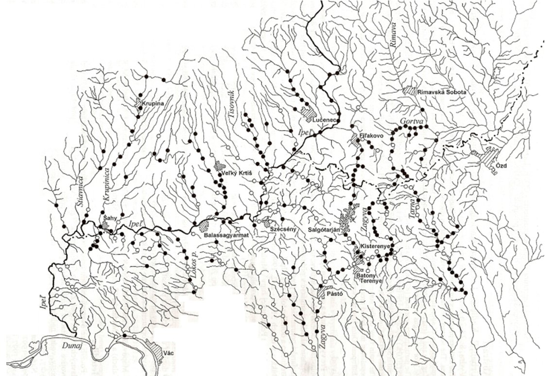 |
| Figure 1. Results of the otter survey in the Novohrad/Nógrád region (Urban and Kadlečík, 1998) (click for larger version) |
The second mapping was carried out in November 1997 (Urban and Kadlečík, 1998; Urban et al., 1997) and the third (summer) one was held in September 1998 (Urban et al., 2000). The results showed that the otter population in southern Slovakia and northern Hungary can be considered viable and has a great potential to spread westward and northward (e.g. Kadlečík, 1998). The information gathered from these mappings is being used to understand otter distribution in general.
Several mappings of otter activity were carried out in the Slovak part of this territory - Novohrad region (Hrivnák and Urban, 1995), middle part of the Ipeľ river catchment (e.g. Urban 1992), Cerová vrchovina Protected Landscape Area (PLA) (e.g. Hrivnák and Balázs, 1995a, b), Lučenská and Ipeľská kotlina basins (e.g. Tučeková and Urban, 2000; Urban, 2000; Urban et al., 2008). In the Cerová vrchovina PLA, otters are common on water flows with a sufficient trophic base. The greatest density of spraints was recorded around water reservoirs in the agricultural area (Balázs et al., 2010).
There are conflicts between the interests of fisheries and nature protection, both in fish farms (ponds) and fresh flowing waters (rivers, small streams). Reliable scientific information on ecology, and potential risks, which are all important for evaluating conservation status, are still insufficient. In winter of 2010-2011, we carried out further mapping of the otter distribution was done in the central part of the Slovak-Hungarian border. The aim of this paper is to summarize knowledge on the current distribution of otters in the study area based on this survey.
STUDY AREA
The study area, situated in south-central Slovakia and north-central Hungary, is mostly a lowland landscape with intensely cultivated fields. The area comprised sections of two river catchments (Ipeľ/Ipoly and Zagyva). Concerning potential Eurasian otter habitats, this area offers the following types of wetlands: rivers, small streams (creeks, brooks), channels, artificial (man-made) water reservoirs, and small fish ponds used for carp production.
Ipeľ (Slovak) or Ipoly (Hungarian) is a 232 km long river in Slovakia and Hungary and a tributary of the Danube River. Its source is in central Slovakia in the Slovenské rudohorie Mountains. It flows south to the Hungarian border, and then southwest, west and again south along the border until it flows into the Danube near Szob. The catchment of the Ipoly river is 5,118 km2, of which 1,521 km2 is located in Hungary. The discharge comes from Slovakian tributaries and consequently, the dynamics of water output are controlled by the Slovakian streams. Rainfall contributes to this but the volume is about 720 mm in the Slovakian and 600 mm in the Hungarian parts of the catchment. Dynamics of the water regime are extreme because the natural reservoirs have a small capacity. An arid period lasts from July to October and the replenishing of reservoirs starts in November (Rádai, 1995). After the regulation of Ipoly and its branches the depth of the riverbed and the speed of the water had increased. The vegetation of river valleys (flood forests - softwood Salicetum albae fragilis, hardwood forest communities, and other typical plant communities that once bordered this river section) has been severely degraded over the last two centuries.
Zagyva River is a 160 km long river in northern Hungary. It originates near Salgótarján and flows into the Tisza River at Szolnok. Salix spp. and Populus spp. dominate in the riparian vegetation.
Parts of the Ipeľ/Ipoly River basin were officially declared as Wetlands of International Importance (so called Ramsar site): Poplie (in Slovakia; 40.9 ha; declared in 1998) and Ipoly Valley (in Hungary; 2,227 ha; declared in 2001) (Fig. 2). In 2007, these areas were recognised as a Transboundary Wetland of Importance by Hungary and the Slovak Republic. This long, flat and narrow valley contains oxbow lakes as well as shrub and alder bogs, which serve to minimize risks of flood damage. Seasonally flooded meadows are partly grazed by cattle and partly mowed, and groundwater replenishes drinking water supply. The site is an important stopover for migratory water birds and offers habitat to a significant number of fish species, some of them endangered, though its role as an important fish spawning ground has declined (Anonymous 2011a,b). Few serious threats to the site are foreseen, though increased cattle grazing and greater use of artificial fertilizers would not be welcome. This Ramsar site is also important for the otter population in southern Slovakia and northern Hungary (Urban et al., 2010, 2011).
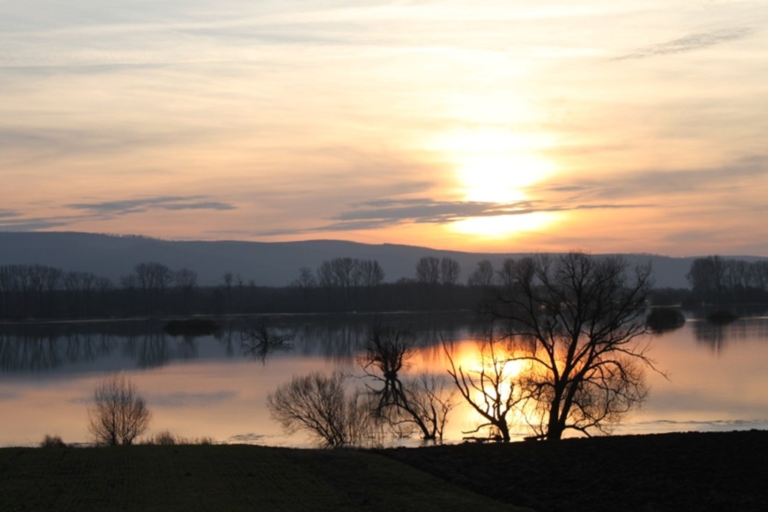 |
| Figure 2. Poiplie – Ramsar site in January 2011 (photo P. Urban) (click for larger version) |
To protect otter habitats in the study area, three Areas of European Interest (Alúvium Ipľa, Cerová vrchovina, and Dálovský močiar) have been designated, which were included in the Natura 2000 sites.
There are two Protected Landscape Areas in our study area: Cerová vrchovina (16,278 ha; declared in 1989) in Slovakia and Karancs-Medves (6,709 ha; declared in 1989) in Hungary.
METHODS
The mapping was undertaken in winter 2010-2011, during 14 days (between December 2010 and March 2011) by searching for signs of presence of the otter (footprints, anal gland secretions, spraints). We checked 351 chosen survey points (50-m lines, 242 points in Hungary, 109 in Slovakia) distributed along two rivers and brooks’ catchments throughout this area. At every site, all signs of otter presence were surveyed. Spraints were rated in three categories - fresh (max. up to 5 days), medium (dry but between 6 and14 days), and old (dry, several weeks old, compact or broken into smaller components) (Bas et al., 1984; modified by Urban and Topercer, 2001). The otter presence marks and shelters were studied along on 300-m stretches (Urban et al., 2010). Using this methodology information on density of otters cannot be obtained. The survey sites start at bridges, other features, or points of access. Survey sites were preferably located under bridges (299) and the others were located along the riverbanks (29) and channels (3) without objects, small water reservoirs (5), fishpond (1), other types of wetlands (4), and fjord (1). The site was considered “positive” when at least a single otter sign was found and “negative” when no otter sign was found. The role of bridges as potential barriers for safe otter migration were also assessed, because otter road kills are currently among the most important recorded reasons of its mortality.
RESULTS
During the mapping of otter distribution in the middle of Ipeľ River and Zagyva River basins, we checked 351 localities. In total, 155 sites (44.1 %, 105 in Hungary and 50 in Slovakia) were positive and 196 (55.8 %, 137 in Hungary and 59 in Slovakia) were negative (Fig. 3).
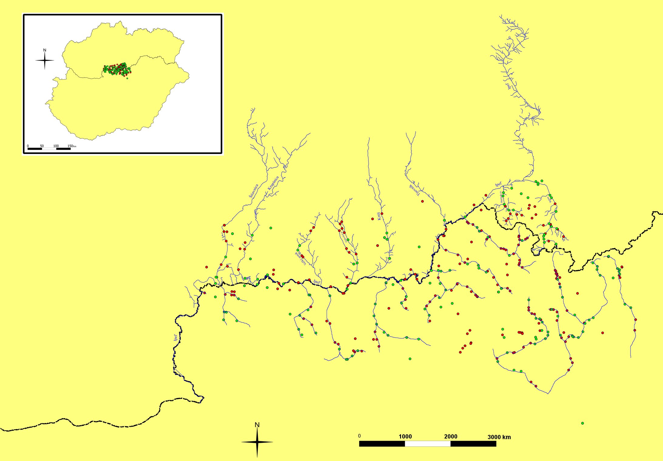 |
| Figure 3. Map showing the location of the study area (green circles represent presence of spraints and red circles represent absence of spraints) (map author Ľ. Repiský) (click for larger version) |
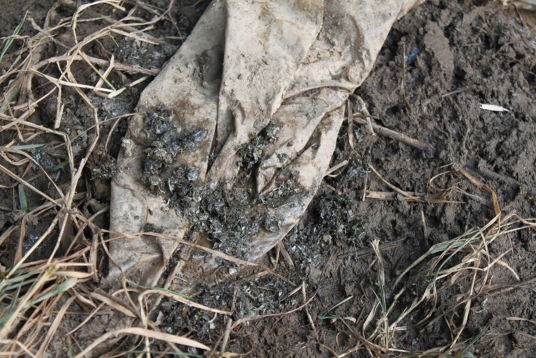
In total, we have found 736 otter signs (spraints and scents): 88 (11.9 %) fresh spraints, 95 (12.9 %) medium spraints, 484 (65.8) old spraints, and 69 (9.4 %) scents. These were distributed throughout the mapped areas, although 612 (83.2 %) were concentrated under the bridges. Otters deposited spraints usually on specific substrate, mostly on blocks over 401 mm in size (201; 27.3 %), concrete (189; 25.7 %), stone concrete (125; 17.0 %), and stones 151-250 mm in size (112; 15.2 %).
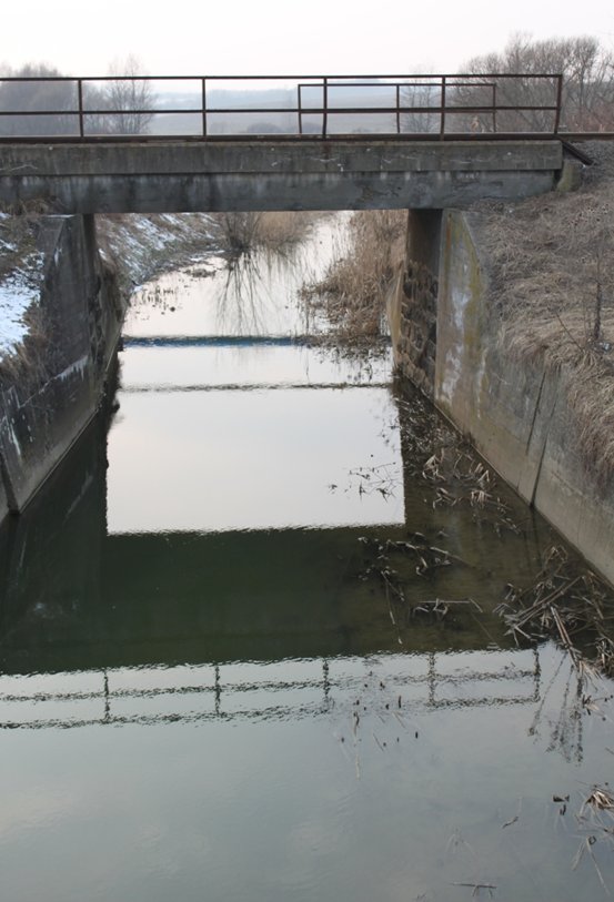
For 299 localities representing bridges over rivers, small streams and channels (e.g. Fig. 4), 179 (59.9 %) were positive and 120 (40.1 %) were negative. Altogether, 185 (61.9 %) bridges and culverts were passable and 114 (38.1 %) (e. g. Fig. 5) were not passable for the otters during mapping. This fact was also determined by the low water flow of most streams, which allowed passage of objects, crossing rivers, creeks, brooks, and channels.
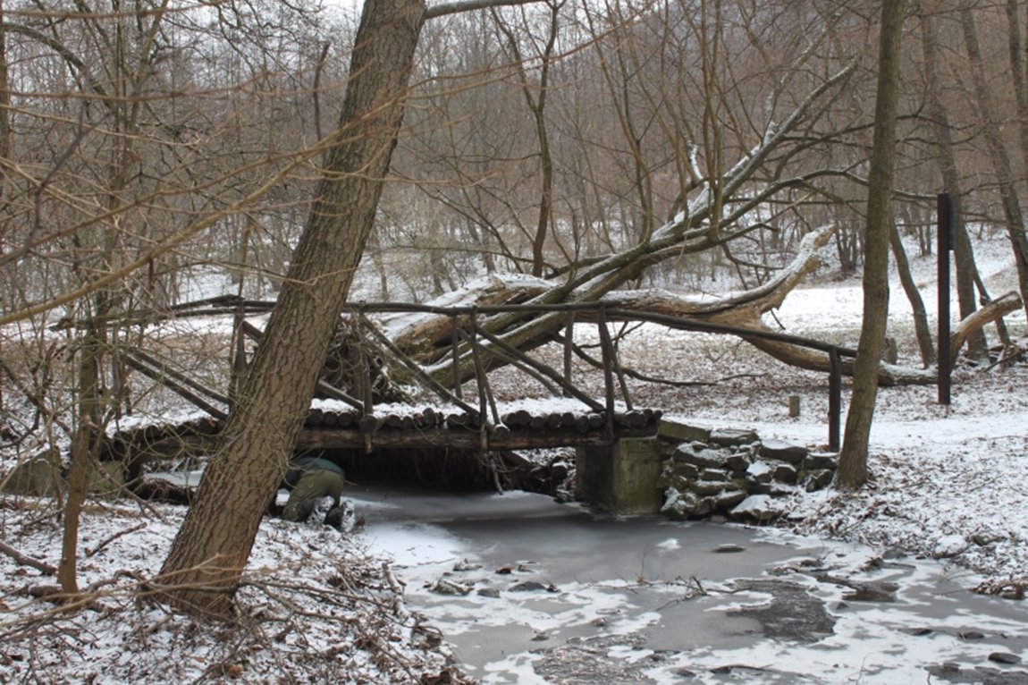
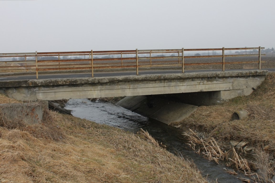
Spraints, scents, and footprints were also found in the case of types of bridging (bridges, culverts) without sprainting sites, but then on the banks (on grass, stones, boulders, blocks, stone concrete, or concrete) next to these objects (e.g. Fig. 6, 7).
Otter signs were distributed on all streams in the study area. We found most otter signs along streams with widths of 2-5 m (306; 41.6 %) and depths of less than 30 cm (398; 54.1 %). The presence of the Eurasian otter has been confirmed in two Special Areas of Conservation (SAC, Sites of European Importance): Alúvium Ipľa and Cerová vrchovina. Negative results were found in SAC Dálovský močiar. The main water flow of the surveyed rivers and brooks provides good permanent habitat for the otter, mainly Ipeľ River (Fig. 8) and its larger tributaries (Belina, Krtíš, Plachtinský potok, Lókos patak), as well as Zagyva River.
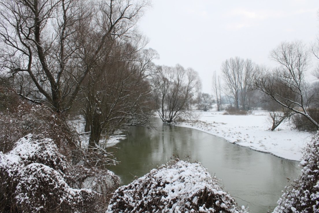 |
| Figure 8. Ipeľ/Ipoly River – example of an optimal habitat for otters (photo P. Urban) (click for larger version) |
Most of the small streams in the study area underwent considerable and unfavourable changes and now represent suboptimal and marginal habitats (regulated and narrow brooks). However, otter signs have been found even in these habitats. In our study area, the otter inhabits artificial canals that offer sufficient food resources and high herbaceous vegetation providing shelter. Man-made channels (Fig. 9) connect rivers and small streams with ponds or small reservoirs, and pass through different wetlands in agricultural landscapes. Most of the irrigation and drainage channels have disappeared during the last 20 years.
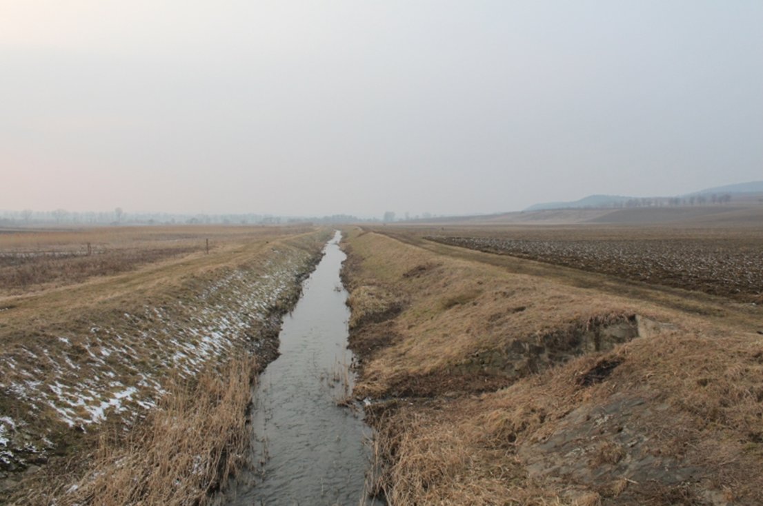 |
| Figure 9. Narrow channel in agricultural landscape (photo P. Urban)(click for larger version) |
DISCUSSION
Spraints are the most durable of otter scent marks and some of them, for example those deposited under bridges, may persist for up to 1 year (MacDonald and Mason, 1988; Brzeziński and Romanowski, 2006). The disappearance of spraints is exponential with time and most (approx. 90%) usually vanish within 7–8 weeks (Jenkins and Burrows, 1980; Mason and MacDonald, 1986). Otter response to the disappearance of spraints (washing away by flood or experimental disturbance) does not involve an increase in overall defecation rate (Brzeziński and Romanowski, 2006).
Results from south-central Slovakia (Urban and Topercer, 2001) demonstrated that sprainting behaviour was significantly seasonal with most of fresh spraints occurring in the winter. Individual spraint types showed a somewhat different seasonal pattern as the peak average numbers for fresh spraints that occurred during December - January and March, for old spraints in March and November - December, and for scent signs in January (Urban et al., 2010, 2011). Therefore, we carried out our mapping in winter.
The amount of water in streams is important for the otter’s survival. Effects of water level, precipitation, and water flow can not only mask the influence of other variables on otter sprainting activity (e.g. Pedroso et al., 2007) but may also influence the passage of objects. On the other hand, low water levels in summer, insufficient food, and habitat loss has been identified during the previous mappings in the study area (Urban et al., 2000). Analysis of otter spraints from the Zagyva River catchment (samples from 1999) revealed a considerably unusual diet composition with surprisingly low frequency of fish (56.3 %), suggesting that food abundance for otters in this area is not sufficient (Koščo and Balázs, 1999; Koščo et al., 2000).
Optimal habitats for otters are defined as areas with unregulated rivers with trees and other plants providing good bankside cover (e.g. Macdonald and Mason, 1982; Bas et al., 1984; Lodé, 1993; Ruiz-Olmo et al., 2005), high prey availability (Kruuk et al., 1993; Beja, 1996), as well as low water pollution and human disturbance (Lunnon and Reynolds, 1991; Robitaille and Laurence, 2002; Ruiz-Olmo et al., 2005).
Sites of European Importance Alúvium Ipľa (406.1 ha) and Cerová vrchovina (2626,5 ha) are sufficiently large, with heterogenic and diverse mosaic of aquatic habitats, that provide adequate protection for otter. In smaller SAC Dálovský močiar (90,2 ha) were recorded negative results. Similar negative results were also found during the otter mapping in 91 SACs in summer 2010 (Urban et. al., 2010).
In study area, the otter inhabits artificial channels and small streams too. For small streams, it is very difficult to determine whether otters are present permanently or occasionally, or if they completely avoid these places (Gera, 2005). Considering that narrow streams have smaller discharges for diluting run-off, a stronger relationship would be predicted after correcting for the areas of water (Durbin, 1998). Dried-out or destroyed channels can be an issue for otter conservation, by potentially affecting their migration routes, or the links between different fishing areas (Gera, 2005). Most of the area mapped is intensively used for agricultural purposes. Agricultural practices are usually thought to be detrimental to otters owing to the effects of drainage, erosion, pesticide run-off, and nitrification (Foster-Turley et al., 1990). Kemenes and Demeter (1995) found a positive effect of land cultivation on the occurrence of otters around aquatic habitats in Hungary. There are indications that otters may use these man-made habitats in agricultural land (Lanszki, 2009; Urban et al., 2011). Results from systematic research of this species in the anthropic affected landscape in a broad Lučenec region (in northern part of study area in this paper) in 2007-2008 confirmed, that the otter occurs along nearly of all of mapping streams (Urban et al., 2008). Otters inhabited all of the studied stagnant waters but were less common in smaller streams (76%) (Lanszki, 2009).
Collisions between otters and cars in Slovakia have been described in sections of crossing roads with water bodies when so called “impassable” types of bridging (bridges, culverts) were used, which put otters off from passing under the road. Such “impassable” types of objects include pipe or frame culverts and those types of bridges where the water fills the space between vertical trestlework and walls of abutments temporarily or permanently in such a way that there is no elevated horizontal or bevelled surface from rather compact material where the otter could pass (Urban et al., 2010).
The Eurasian otter occurs in most of the study area. Results from both one-off otter mappings in Slovakia in winter 2007-2008 and in summer and autumn 2010 in a network of quadrats from the Databank of Slovak Fauna (DFS) grid (approx. 10 × 12 km), showed otter occurrence in all quadrats in this area. All 16 quadrats were positive (Urban 2010a; Urban et al. 2010). During verification of this methodology in the Krupinská planina (Krupina plateau Mts.) and Ipeľská kotlina (Ipeľ river basin) in autumn 2007, 14 quadrats (11 in Slovakia and 3 in Hungary) were controlled and all of them were positive (Urban, 2010b).
Results of otter mapping on the Hungarian side in 2004-2005 also confirmed the presence of otters in this part of the country. In all controlled UTM grid squares (10 × 10 km), located in our study area, had occurrences of otters. The Ipoly River basin was found to have a stable or increasing otter population, which is widespread throughout the mapping area, especially in tributaries with dead branches and plenty of fish (Gera 2004, 2005).
CONCLUSION
The otter population in the central part of the Slovak-Hungarian border area was considered stable and otters occurred throughout this area. During the winter mapping in 2010-2011, 44.1 % of controlled localities were positive. The otter was regularly observed in optimal habitats, represented mainly by Ipeľ and Zagyva rivers and its larger tributaries but also in suboptimal and marginal habitats such as regulated and narrow brooks and channels.
In the study area it is necessary not only to know distribution of otters, but population size and other aspects of biology and ecology this species, including risks factors too. Therefore we recommend to:
- carry out winter mapping of the distribution of otters at least once every 5 years;
- carry out snow tracking surveys - winter census of otters (Poledník et al., 2008) - depending on snow conditions in Special Areas of Conservation and Protected Landscape Areas;
- carry out regular monitoring for reporting in accordance with Article 17 of the Council Directive 92/43/EEC of May 21 1992 on the Conservation of natural habitats and wild fauna and flora (EC Habitats Directive) in all areas of European importance, in which is otter protected;
- carry out otter mapping in water reservoirs, dams and other water bodies;
- monitor threats to otter survival regularly;
- improve education and increase awareness of the importance of the otter and the need of its protection among target groups and stakeholders;
- ensure proper control of all protected areas with presence of otters through management plans.
The Eurasian otter population of southern Slovakia and northern Hungary is considered to be viable with potential for spreading to the south and west, but some measures to ensure recovery of certain areas are necessary to:
- remove concrete works and channels and restore stream habitat;
- improve water management and water regime in the area;
- construction of road underpasses, for otters and other animals on road to prevent mortality due to road traffic.
It is important to ensure protection of otter, and survival its populations in a favorable status, when population dynamics data of the species indicate that is maintaining itself on a long-term basis as a viable element of this natural habitats, a natural range of this species does not reduce and there is a sufficiency of habitats to maintain its population on a long-term basis.
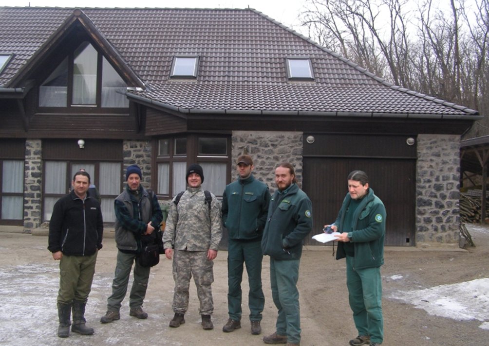
Acknowledgements - We would like to thank to Istvánné Lantos, Sándor Szabó, and Erika Urbanová for their assistance with fieldwork. We also thank to Ľubomír Repiský for preparation of the map and Andrej Šijak for helping us to process results. We are grateful to Ladislav Hamerlík for proofreading.
REFERENCES
Anonymous (2011a).The Annotated Ramsar List of Wetlands of International Importance: Hungary. Available at: http://www.ramsar.org/cda/en/ramsar-pubs-annolist-anno-hungary/main/ramsar/1-30-168%5E16366_4000_0__
Anonymous, (2011b). Ipoly Valley. Available at: http://www.cwi.sk/hungary.php.
Balázs, Cs., Benda, P., Estók, P., Uhrin, M. (2010). Živočíšstvo, hodnoty živočíšnej ríše - stavovce (Vertebrata). In: Gaálová, K. (2010). Chránená krajinná oblasť Karancs - Medves a Chránená krajinná oblasť Cerová vrchovina. Riaditeľstvo Národného parku Bükk, Eger-Rimavská Sobota, 157-176.
Bas, N., Jenkins, D. and Rothery, P. (1984). Ecology of otters in northern Scotland. The distribution of otter (Lutra lutra) faeces in relation to bankside vegetation on the river Dee in summer 1981. Journal of Applied Ecology, 21(2): 507-513.
Beja, P. (1996). Temporal and spatial patterns of rest-site use by four female otters Lutra lutra along the Southwest coast of Portugal. Journal of Zoology (London),239: 741–753.
Bihari, Z., Csorba, G. and Heltai, M. (eds.) (2007). Magyarország emlőseinek atlasza. Kosuth Kiadó, Budapest, 360 pp.
Brzeziński, M. and Romanowski, J. (2006). Experiments on sprainting activity of otters (Lutra lutra) in the Bieszczady Mountains, southeastern Poland. Mammalia, 70: 58–63.
Conroy, J.W.H. and Chanin, P.R.F. (2002). The status of the Eurasian otter (Lutra lutra). IUCN OSG Bulletin, 19A: 24-48.
Durbin, L. S. (1998). Habitat selection by five otters Lutra lutra in rivers of northern Scotland. Journal of Zoology (London), 245: 85-92.
Foster-Turley, P., MacDonald, S. and Mason, C. F. (1990). Otters. An Action Plan for their Conservation. IUCN, Gland, 126 pp.
Gera, P. (2004). Otterbook. Summary report on Finished otter protection programmes of the Organisation on the Foundation for Otters between 1995-2004 in Hungary. Foundation for Otters Hungary, Budapest, 40 pp.
Gera, P. (2005). Summary report on the results of the population survey of the Otter (Lutra lutra Linnaeus, 1758) carried out in Hungary, between March 2004 and June 2005. Foundation for the Otters, Budapest, 16 pp.
Hrivnák, R. and Balázs, P. (1995a). Rozšírenie vydry riečnej (Lutra lutra L.) v Cerovej vrchovine. In: Urban, P. and Baláž, D. (eds.), Výskum a ochrana cicavcov na Slovensku. SAŽP-Centrum ochrany prírody a krajiny, Banská Bystrica: pp. 91-93.
Hrivnák, R. and Balázs, P. (1995b). Výskyt vydry riečnej (Lutra lutra L.) v Cerovej vrchovine. Bulletin Vydra, 5: 35–40.
Hrivnák, R. and Urban, P. (1995). Vydra riečna (Lutra lutra L.) v Novohrade. In: Urban, P. (ed.). Výskum a ochrana cicavcov na Slovensku II. SAŽP, Banská Bystrica: pp. 59-69.
IUCN (2001). The IUCN Red List of Threatened Species: Mammals of Hungary. IUCN. 2001.
Jenkins, D. and Burrows, G.O. (1980). Ecology of otters in northern Scotland. III. The use of faeces as indicators of otter (Lutra lutra) density and distribution. Journal of Animal Ecology,49: 755-774.
Kadlečík, J. (1998). Poznámky k rozšíreniu vydry riečnej (Lutra lutra) v oblastiach priľahlých k riekam Morava a Dunaj v rokoch 1994-1998. Bulletin Vydra, 8: 17-22.
Kemenes, I. (1991). Otter Distribution, Status and Conservation Problems in Hungary. IUCN OSG Bulletin,6: 20-23.
Kemenes, I. and Demeter, A. (1995). A predictive model of the effect of environmental factors on the occurrence of otters (Lutra lutra L.) in Hungary. Hystrix, 7: 209-218.
Koščo, J., Košuth, P. and Urban, P. (2000). Neobvyklá potrava vydry riečnej (Lutra lutra L.) z povodia rieky Zagyva v severnom Maďarsku. Bulletin Vydra, 9-10: 19-22.
Koščo, J. and Balázs, P. (1999). Adatok a Nógrád Megyei vidraálomány (Lutra lutra) táplálkozásbiológiájáhos. Pusta, 16: 139-144.
Kruuk, H. (2006). Otters: ecology, behaviour and conservation. Oxford University Press. Oxford, pp. 265.
Kruuk, H., Carss, D.N., Conroy, J.W. and Durbin, L. (1993). Otter (Lutra lutra) numbers and fish productivity in two rivers in north-east Scotland. Symp. Zool. Soc. London,65:71-191.
Lanszki, J. (2009). Vadon élő vidrák Magyarországon. Natura Somogyiensis, 1: 1-237.
Lodé, T. (1993). The decline of otter Lutra lutra populations in the region of the Pays de Loire, Western France. Biological Conservation, 65: 9-13.
Lunnon, R.M. and Reynolds, J.D. (1991). Distribution of the otter Lutra lutra in Ireland, and its value as an indicator of habitat quality. In: Jeffrey, D. W. and Madden B. (eds.), Bioindicators and Environmental Management. Academic Press Limited, London, 435-443.
Macdonald, S.M. and Mason, C.F. (1982). The otter Lutra lutra in central Portugal. Biological Conservation, 22: 207-215.
Macdonald, S.M. and Mason, C.F. (1988). Observations on an otter population in decline. Acta Theriologica, 33: 415-434.
Mason, C.F. and Macdonald, S.M. (1986). Otters, ecology and conservation. Cambridge University Press, pp. 236.
Pedroso, N.M., Sales-Luís, T. and Santos-Reis, M. (2007). Use of Aguieira Dam by Eurasian otters in Central Portugal. Folia Zoologica,56: 365-377.
Poledník, L., Poledníková, K., Roche, K., Hájková, P., Toman, A., Václavíková, M., Hlaváč, V., Beran, V., Nová, P., Marhoul, P., Pacovská, M., Růžičková, O., Mináriková, T. and Větrovcová, J., (2008). Záchranný program – program péče pro vydru říční (Lutra lutra) v České republice v letech 2008 – 2018. AOPK ČR, Praha, 78 pp. (ms.). Available at: http://www.nature.cz/publik_syst2/files08/pp_vydra_final.pdf
Rádai, O. (ed.) (1995). River corridors in Hungary. A strategy for the conservation of the Danube and its Tributaries (1993-94). IUCN, Gland, Switzerland and Budapest, Hungary, 124 pp.
Robitaille, J.F. and Laurence, S. (2002). Otter, Lutra lutra, occurrence in Europe and in France in relation to landscape characteristics. Animal Conservation, 4: 337-344.
Ruiz-Olmo, J., Batet, A., Jiménez, J. and Martínez, D. (2005). Habitat selection by female otters with small cubs in freshwater habitats in northeast Spain. Lutra,48: 45–56.
Tučeková, E. and Urban, P. (2000). Vydra riečna (Lutra lutra L.) v Ipeľskej kotline. Bulletin Vydra, 9–10: 5–14.
Urban, P. (1992). Rozšírenie vydry riečnej (Lutra lutra L. 1758) na strednom toku Ipľa. Chránené územia Slovenska, 18: 45.
Urban, P. (2000). Vydra riečna v cezhraničnej oblasti stredného toku rieky Ipeľ. Životné prostredie, 1(34): 30–34.
Urban, P. (2010a). The Eurasian otter in Slovakia – A preliminary report from a survey. IUCN Otter Spec. Group Bull., 27: 148-157.
Urban, P. (2010b). Rozšírenie vydry riečnej (Lutra lutra L.) v Krupinskej planine a Ipeľskej kotline - overovanie metodiky celoslovenského mapovania. In: Urban, P. and Uhrin, M. (eds.) Príroda Príbeliec a širšieho okolia Mikroregiónu Východný Hont. Zborník referátov z odbornej konferencie (23.-24. 11. 2007). Obecný úrad Príbelce a Katedra biológie a ekológie FPV UMB v Banskej Bystrici, pp. 185–191.
Urban, P. and Kadlečík, J. (1996). Výsledky slovensko-maďarského mapovania vydry riečnej (Lutra lutra) v roku 1996. Bulletin Vydra, 7: 38-43.
Urban, P. and Kadlečík, J. (1998). Ďalšie poznatky o vydre riečnej v širšom regióne Novohradu. Bulletin Vydra, 8: 23-26.
Urban, P., Topercer, J. (2001). K značkovaciemu správaniu vydry riečnej (Lutra lutra L.) na strednom Slovensku. Folia venatoria, 30-31: 207-224.
Urban, P., Kadlečík, J. and Hrivnák, R. (1996). Slovensko–maďarské mapovanie vydry riečnej. Chránené územia Slovenska, 27: 28–30.
Urban, P., Hrivnák, R., Kadlečík, J. and Márton, F. (1997). Vydra riečna (Lutra lutra L.) v Novohrade. In: Urban, P. and Hrivnák, R. (eds.): Poiplie. SAŽP, Banská Bystrica, pp. 83-94.
Urban, P., Balázs, P., Valach, I. and Tučeková, E. (2000). Letné mapovanie vydry riečnej v Novohradskej župe Maďarskej republiky. Bulletin Vydra, 9-10: 15-18.
Urban, P., Hrivnák, M., Mihalčák, J. and Hrivnák, R. (2008). Vydra riečna (Lutra lutra L.) v antropicky ovplyvnenej krajine – poznatky zo širšieho okolia Lučenca. Natura Carpatica XLIX, 183-194.
Urban, P., Kadlečík, J., Topercer, J. and Kadlečíková, Z. (2010). Eurasian otter (Lutra lutra L.) in Slovakia. Distribution, biology, risks and conservation. Faculty of Natural Sciences, Matthias Belius University, Banská Bystrica, pp. 128.
Urban, P., Kadlečík, J., Topercer, J., Kadlečíková, Z. and Hájková, P. (2011).Vydra riečna na Slovensku. Rozšírenie, biológia, ohrozenie a ochrana. Fakulta prírodných vied UMB, Banská Bystrica, 165 pp.
Žiak, D., Urban, P. (2001). Červený (ekosozologický) zoznam cicavcov (Mammalia) Slovenska. Ochrana prírody, 20 (Suppl.): 154–156.
Résumé : La Loutre (Lutra lutra) dans la Partie Centrale de la Zone Frontaliere entre Slovaquie et Hongrie
La cartographie de la distribution de la Loutre (Lutra lutra) dans la partie centrale de la frontière slovaque-hongroise a été entreprise durant l'hiver 2010/2011 en recherchant les signes de présence de l'espèce. Les auteurs ont vérifié 351 sites (50m de transect, 242 sites en Hongrie et 109 en Slovaquie). Sur chaque site, tous les signes de présence ont été recensés. Les sites ont préférentiellement été définis sous les ponts (299 sites) et ont ensuite été considérés soit comme «positifs» ou «négatifs». Au total, 155 sites (44,1%, 105 en Hongrie et 50 en Slovaquie) étaient positifs et 196 (55,8%, 137 en Hongrie et 59 en Slovaquie) ont été négatifs. Les loutres ont généralement déposé leurs épreintes sur un substrat spécifique, principalement sur des blocs (201; 27,3%), du béton (189, 25,7%), et du béton mélangé à de la pierre (125, 17,0%). Au total, 185 (61,9%) des ponts et autres passages ont été considérés comme praticables et 114 (38,1%) ne l'étaient pas. Les loutres ont été régulièrement observées dans des habitats optimaux (par exemple sur les rivières Ipel et Zagyva ainsi que sur leurs affluents les plus larges), mais aussi dans des habitats sous-optimaux et marginaux tels que les ruisseaux étroits et les canaux. La population de loutres dans la partie centrale de la zone frontalière "Slovaquie-Hongrie" est donc considérée comme stable et reste présente sur l'ensemble de cette zone.
Revenez au dessus
Resumen: La Nutria Euroasiatica (Lutra lutra) en Zona Central del Area Fronteriza dntre Eslovaquia y Hungria
Se ha llevado a cabo la cartografía de la distribución de la nutria euroasiática (Lutra lutra) en zona central del área fronteriza entre Eslovaquia y Hungría durante el invierno 2010/2011 mediante la búsqueda de rastros y señales de la presencia de nutrias. Los autores inspeccionaron 351 puntos de muestreo (transectos de 50 metros, 242 puntos en Hungría y 109 en Eslovaquia). En cada punto se consideraron todos los signos de presencia de nutria. Los puntos de muestreo estuvieron localizados preferiblemente bajo puentes (299) y se consideraron resultados tanto negativos como positivos. En total, 155 puntos de muestreo (44,1%, 105 en Hungría y 50 en Eslovaquia) resultaron positivos y 196 (55,8%, 137 en Hungría y 59 en Eslovaquia) resultaron negativos. Las nutrias depositaron sus excrementos normalmente en sustratos muy específicos, principalmente sobre grandes piedras (>401mm) situadas en la orilla o en la corriente de agua (201; 27,3%), sobre la estructura inferior de hormigón de los puentes (189, 25,7%) y sobre pequeños guijarros y piedras cementados con hormigón en las orillas (125; 17,0%). En total, durante el muestreo 185 (61,9%) puentes y pasos de drenaje fueron transitados por nutrias mientras que 114 (38,1%) no lo fueron. Se observaron nutrias de forma regular en hábitats óptimos (por ejemplo, los ríos Ipel y Zagyva y sus afluentes principales) pero también en hábitat subóptimos y marginales como arroyos y canales estrechos o con cauces regulados. La población de nutrias en la zona central de la frontera entre Eslovaquia y Hungría se considera estable ya que las nutrias son frecuentes en toda la zona.
Vuelva a la tapa